Drought Monitoring
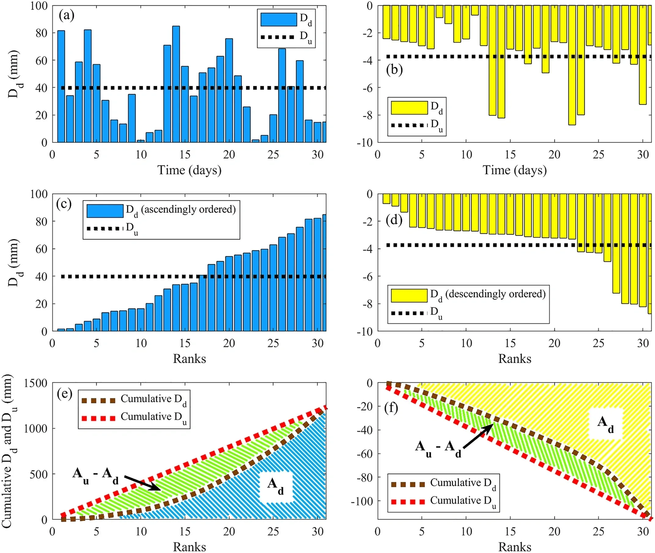
Meteorological droughts indicating the onset of drought propagation are usually quantified through unbiased indices that consider the month-wise magnitude variations in historical climatic variables, while completely ignoring their intramonthly distributions. However, the applicability of such indices under the present scenario of changing climate, where intense short wet spells are reportedly increasing, is questionable. Such changes in the wet spells could eventually lead to prolonged intramonthly dry spells, which in turn will pose many agricultural and socioeconomic risks. To monitor the changed scenario realistically, we propose a new drought index—the Standardized Net-Precipitation Distribution Index (SNEPI), which incorporates the distribution characteristics of the daily net-precipitation variable. The applicability of SNEPI is critically evaluated using synthetically generated and observed precipitation series over six diverse climatic locations of India, at 1-, 3-, 6-, and 12-month time scales.
Compound Extreme & Environmental Flows
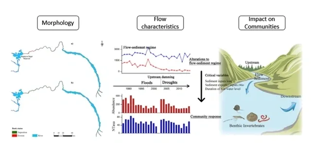
The group is exploring the evolution of compound hydrological extremes under changing climatic conditions. Other group members are assessing the impact of changing flood characteristics on river morphology in collaboration with Queensland University, Australia.
Water System Modelling
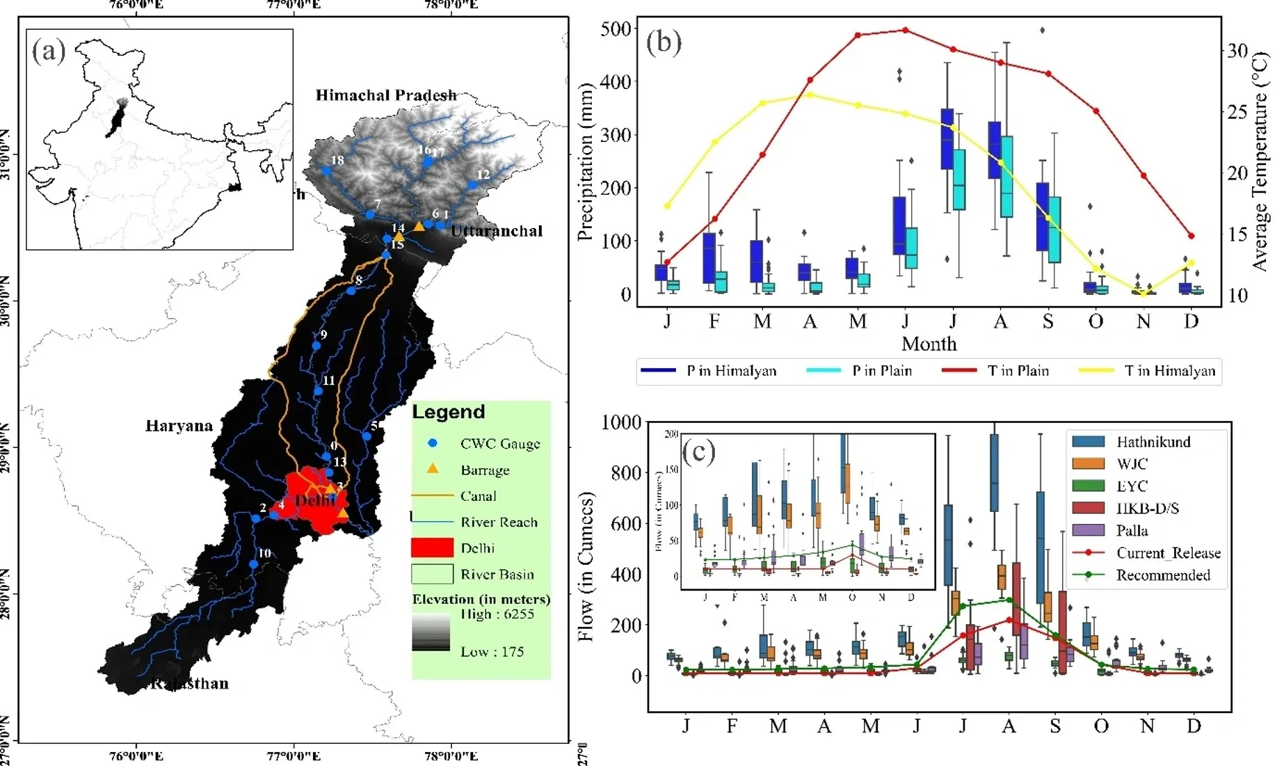
We evaluated the supply and demand side dynamics using the WEAP model in the Yamuna basin. This approach focuses on balancing water demand with available supplies, integrating sustainable practices, and addressing the impacts of climate and socio-economic change to ensure long-term water security and sustainable development of the basin.
Integrated Groundwater Modelling
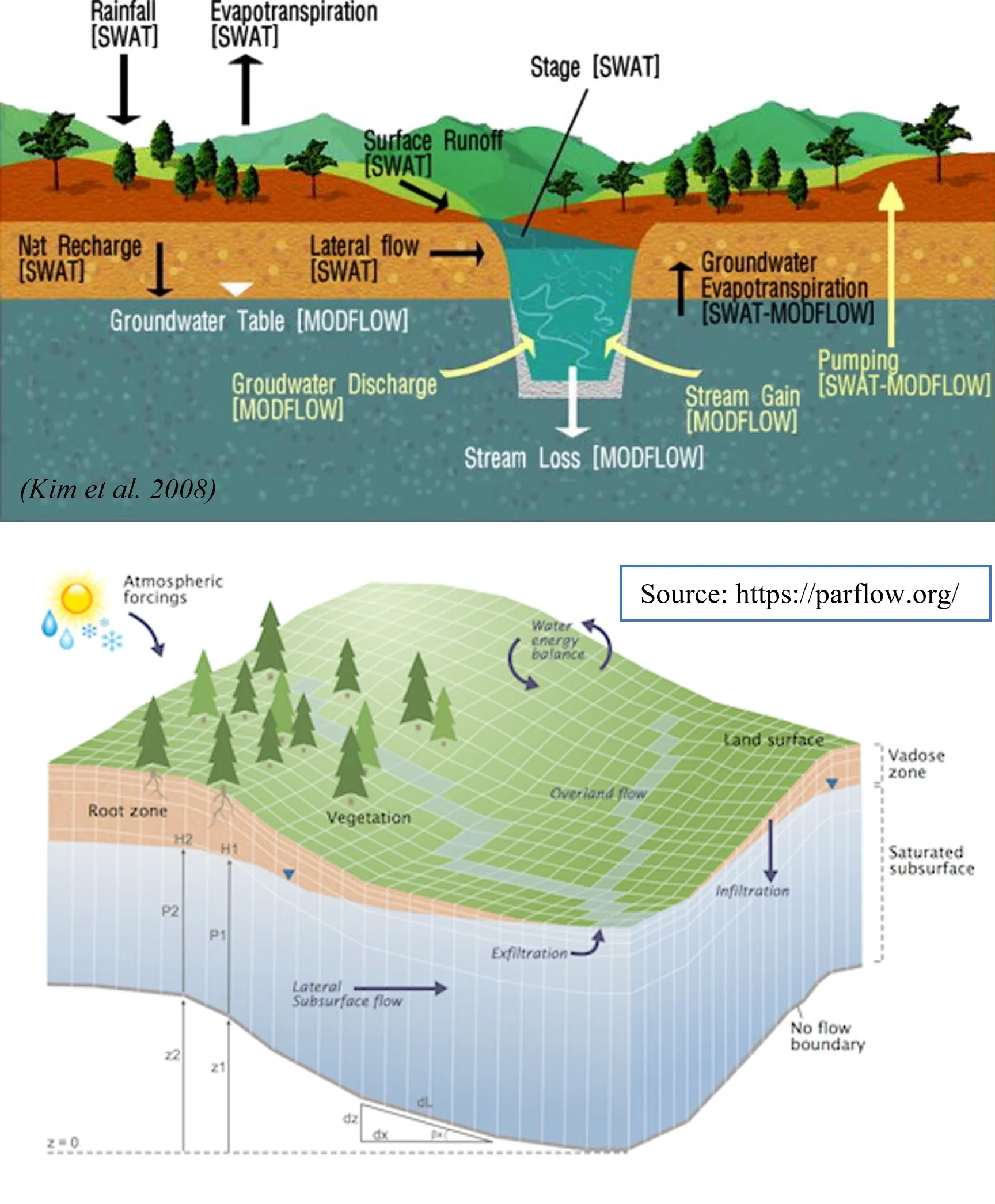
In a collaborative initiative with Forschungszentrum Juelich, Germany, a dedicated team is actively engaged in studying the intricate dynamics of groundwater response to evolving climatic conditions and anthropogenic demands. To achieve this, they are employing sophisticated groundwater models, including Modflow and Parflow, which are renowned in the field. These models enable a detailed simulation and analysis of groundwater behavior. Furthermore, the team is integrating these groundwater models with land surface models, specifically the Community Land Model (CLM). This integration enhances their ability to comprehensively understand the complex interactions between groundwater and surface processes. By combining expertise and resources, this collaborative effort seeks to contribute valuable insights into how groundwater systems are influenced by both natural climate variations and human activities, with the ultimate goal of informing sustainable water resource management strategies.
Flood Monitoring
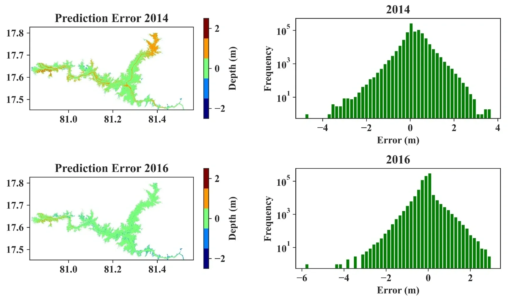
This group focuses on rapid flood inundation modelling using physics-based machine learning with a dedicated wing on assessing the socio-economic damage caused by flood events. Multiple physics-based machine learning models were being developed by providing the routing and topographic characteristics to overcome the high computational time of traditional hydrodynamic models. This helps NGOs and governments to timely evacuate people effected by floods leading to mitigate the number of total fatalities caused by floods.
Moisture Transport
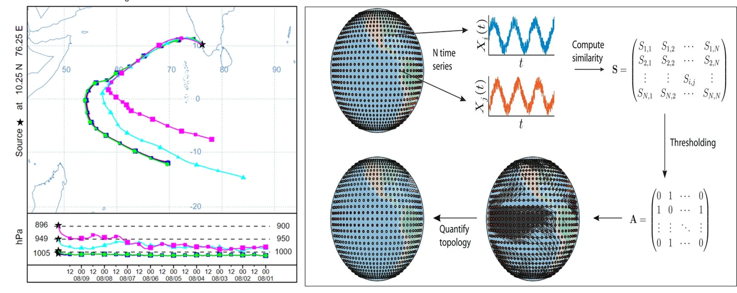
A dedicated framework is being developed to explore land atmosphere interactions through moisture tracking. The group members are studying the inherent non-linear nature of rainfall extremes using complex networks, as well as investigating the urban heat island effect and its impacts on precipitation
Land Surface Processes Modeling
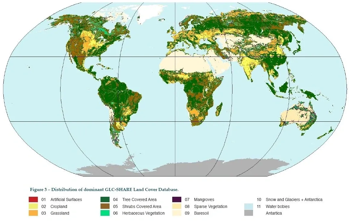
In regional climate modeling, one of the major drivers of climate variability is the natural and human induced land-use land-cover (LULC) changes. Undoubtedly, any potential changes in land-use have impacts on water resources. However, quantifying these impacts and incorporating these processes in any climate model remains a challenging problem in studies on climate change impact on water resources. Regional climate modeling with land surface schemes and dynamic vegetation need to be emphasized especially in tropical regions with heterogeneous land surface, dynamic vegetation growth and spatio-temporally varying irrigation. The rising population and interference of human influences make the problem even more complex. We emphasize on selecting and parametrizing specific land surface schemes which can model and replicate a region's atmosphere-land feedbacks accounting the vegetation heterogeneity. .
Regional Hydrolgic Modeling and Land-Use Land-Cover Changes
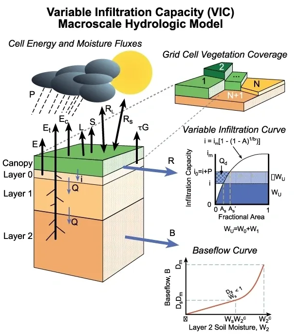
The linkages between water resources and climate is captured through hydrological modeling at a regional or watershed scale. Hydrological modeling helps to attain a good insight into the hydrological processes required for an efficient water resources management. Our research emphasize on parameter estimation on hydrological models and also to assess the climate change impacts in river basins through hydrological models such Variable Infiltration Capacity (VIC), Soil Water Assessment Tool (SWAT) etc. Implications of climate change in hydrologic extremes and water availability in the basin, spatial and temporal scale effects, land-use land-cover changes are essential to be explored.
Hydrolgical Hazards and Extreme Events Modeling
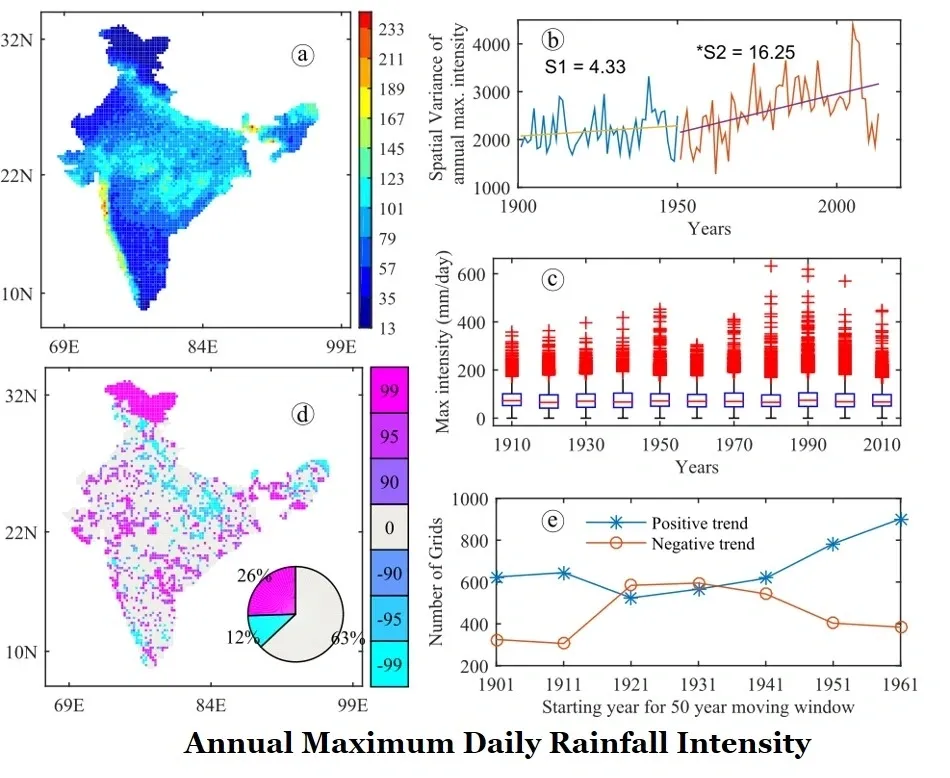
Extreme events though occur rarely, have adverse impact on water resources management. Rarity often limits the application and efficiency of models in simulating these events. Recent revelation of rapid climate change further aggravates this issue. We are particualrly interested in exploring the evolution of extremes, the intensity-duration-frequency characteristics and the effect of non-stationarity and interdependency in extreme event modeling. Effect of dominant teleconnections in extremes, flood and drought prone areas and the associated spatio-temporal severity are topics worth exploring.
Climate Change Impact Assessment and Regional Downscaling
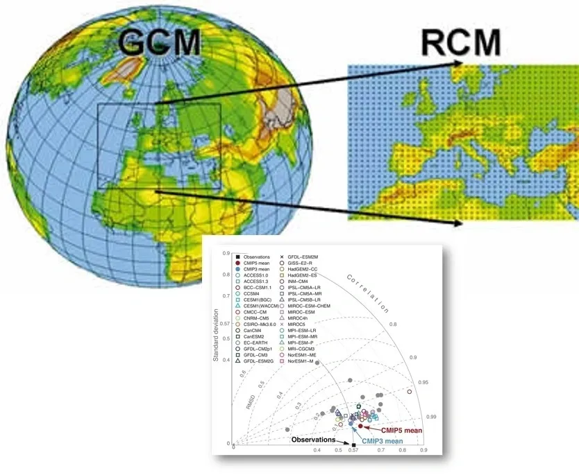
Water resources is inextricably linked with climate. Globally, the negative impacts of future climate change on freshwater systems are expected to outweigh the benefits. Climate change affects the function and operation of existing water infrastructure - including hydropower, structural flood defences, drainage and irrigation systems - as well as water management practices (IPCC, 2008). The primary concerns regarding climate projections while incorporating it in hydroclimatology field are the following: (i) Reliability of future projections and associated uncertainties (ii) Suitable downscaling model which replicates the regional scale hydro-climatic system (iii) Non-stationarity of hydrologic variables and inter-relationship etc. Our group work on developing methodologies to improve the reliability by reducing the uncertainties in future projections.
Well-Observed Time Series Does Speak for Itself!
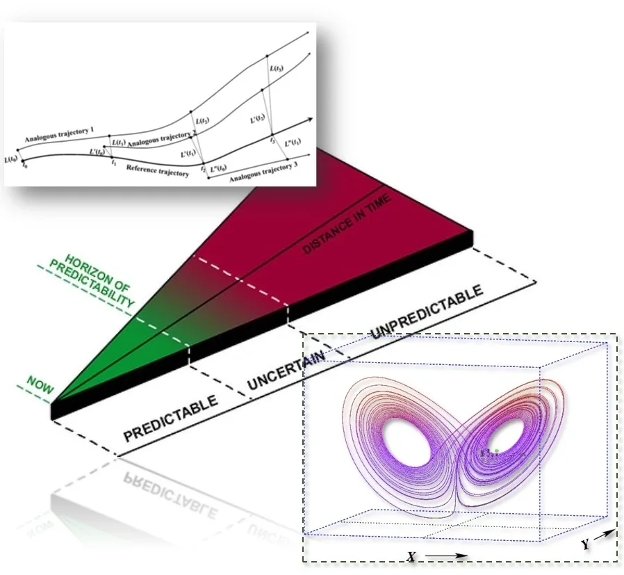
Our research focuses on extracting the inherent characteristics of hydro-climatologic system from the time-series itself. This is particularly significant considering the complexity of the hydro-climate system and the inadequate information of system sub-components. Lack of holistic knowledge about such complex hydro-climatic systems steered us to hypothesise that "A well-observed time-series does speak for itself!" Concepts of chaos theory and phase-space re-construction are applied to unveil the nonlinear physical linkages between global-climatic causative factors and hydrologic-extreme episodes. Novel algorithms are developed to reduce predictive uncertainty by minimizing the infamous butterfly-effect and improving the model perfection. Further, we also focus on mapping and enhancing the predictability of different hydro-climatic variables to improve the hydrological predictions.